An Illustrated History of Old Sutton in St Helens, Lancashire
Part 36 (of 95 parts) - A - Z of Sutton Streets Part 2 (L - Z)
Researched & Written by Stephen Wainwright ©MMXX Contact Me Research Sources
The last time was in 2008 when an Asda home delivery van had its top sliced off! It’s been suggested that the derivation of Lancots Lane is 'Lance Corporal Cotts’, however that is unconfirmed. The first census reference to Lancots Lane occurs in 1871, with just one house and two lodges but it is clearly stated on the 1849 OS map. In the 1851 census there is a reference to Luncarths Lane, although that is not mentioned in any other census. It’s likely that the 1851 census enumerator when enquiring of the name of the street, misheard Luncarths for Lancots.
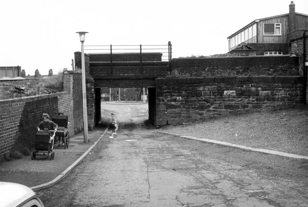
The Lancots Lane bridge in Sutton is only 8' 3" high and was photographed by Fred Clare in 1986

The Lancots Lane bridge in Sutton was photographed by Fred Clare in 1986

The Lancots Lane bridge in 1986
LEA GREEN ROAD (between Elton Head Road, Lowfield Lane & Chapel Lane) - Lea Green is derived from the Old English word ‘leah’, which refers to a clearing / field in a woodland or forest. Merseyside Archaeological Society believe the original Lea Green estate may have been a Lea or Ley holding belonging to Richard de Standish, who owned Sutton property during the 14th century. In the Liverpool Echo of June 10th 1939 Eric Hardy wrote:
LOWFIELD LANE (Lea Green) - Named after Lowfield House, which was situated near the street’s junction with Lea Green Road. The house dates back to at least 1588. It was then owned by 66-years-old Hugh Ley, whose surname was probably derived from the place name Lea Green, and not the other way round. The house was listed on 19th and early 20th century Ordnance Survey maps, when situated near to the railway station. However on the 1937 OS map, the location is referred to as Lowfield Farm.
MARGARET AVENUE (off Kent Road, near Sutton Park) - Like the adjacent Rose Avenue, the short street was named after Princess Margaret (1930 – 2002). The street name was chosen by builders A. J. Kenwright of Robins Lane, who mainly chose names with Royal connections for the houses they built near Sutton Park.
MARINA AVENUE (off Robins Lane, near Sutton Park) - Named after Princess Marina of Greece and Denmark (1906 – 1968), who became the Duchess of Kent. Born in Athens, Princess Marina’s marriage to Prince George, Duke of Kent, the fourth son of King George V, was the last occasion in which a foreign-born princess married into the Royal Family. Marina’s cousin was Prince Philip and her mother was a granddaughter of Tsar Alexander II of Russia. The name of Marina Avenue was chosen by builders A. J. Kenwright of Robins Lane, who mainly chose street names with Royal connections for the houses they built near Sutton Park. These names were then approved by St.Helens Council.
MARSHALLS CROSS ROAD - This was so-named because roadside crosses used to be placed on highways so that travellers could stop and pray for their safe journey. 'Marshall' is a word of German-French derivation that means 'Master of the Horse' and it came to denote the local farrier. So it is probable that there was a blacksmith or farrier on the route who shoed the horses that passed through.
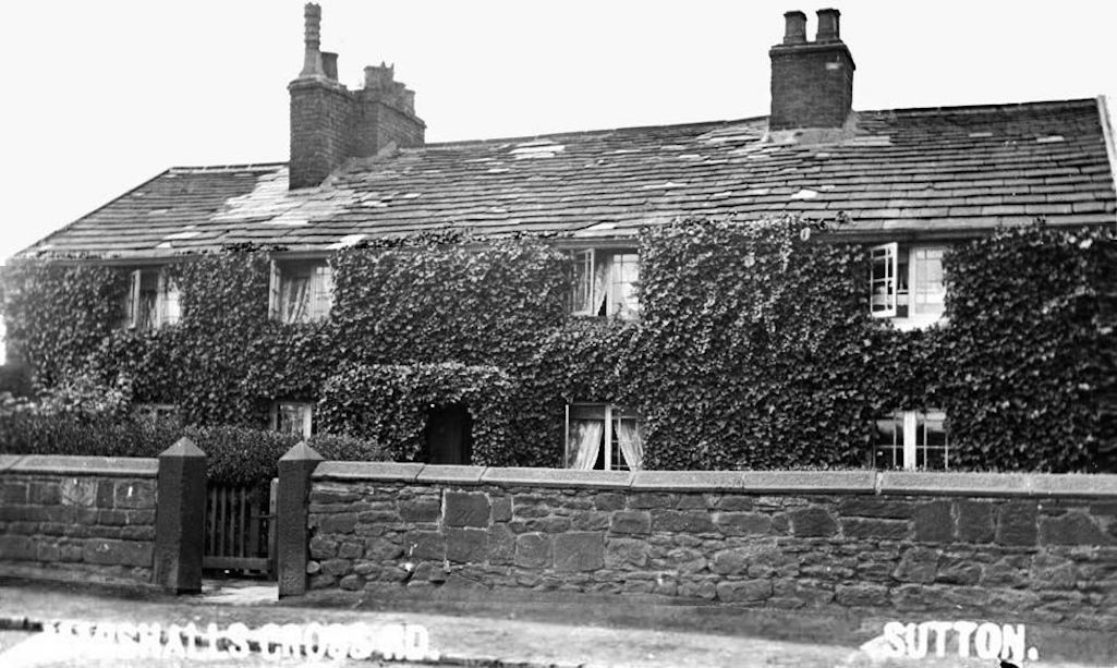
These cottages in Marshalls Cross Road were demolished during the mid 1960s

Marshalls Cross Road cottages which were demolished during the mid 1960s

Marshalls Cross Road cottages
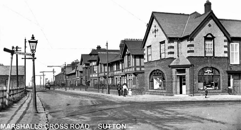
A postcard of the junction of Marshalls Cross Road and Robins Lane taken around 1910 - 1915

The junction of Marshalls Cross Road and Robins Lane around 1910 - 1915

Junction of Marshalls Cross Road and Robins Lane around 1910 - 1915
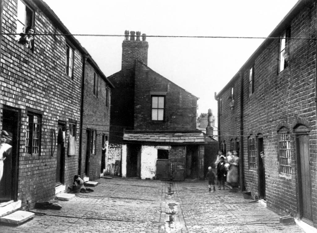

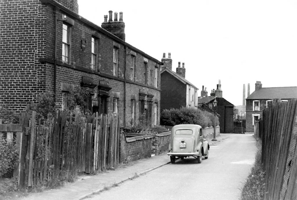
Monastery Lane in 1960 looking towards the Golden Cross pub with the chimneys of Bold Power Station and Colliery

Monastery Lane in 1960 looking towards the Golden Cross

Monastery Lane pictured in 1960
NEW STREET - The street belies it's name being at least 200 years old and is referenced on Greenwood's Map of Lancashire of 1818. It was obviously a new road at some point, which gave it its name. There is a comprehensive article on the history of New Street in the How Sutton’s Changed page.
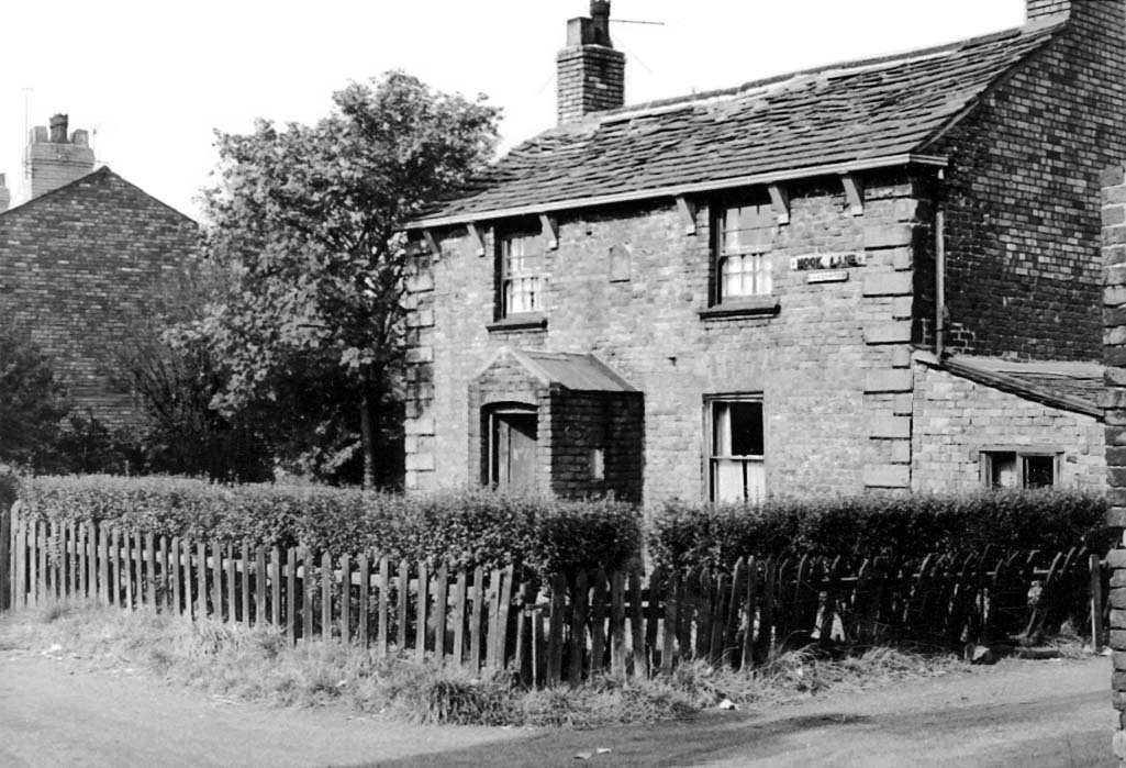
NOOK LANE (between Watery Lane and Sutton Moss Road and including Moss Nook and Sutton Nook) - Nook refers to a secluded, out of the way place which describes Nook Lane, near Sutton Moss. This first first appears on the 1891 census with eight cottages listed. Peat turf was extricated from Sutton Moss for use as firelighters or animal bedding litter.
NORMANS ROAD / LANE (off Helena Road) - Probably named after William and Mary Norman. In the 1851 census Mary aged 73 is described as a widowed house proprietor resident in Normans Lane. The street (or streets) predates by some years the naming of other roads in the St.Helens Junction district that bear male Christian names and so it is likely that the surname of the couple was adopted as the street’s name. Part of Normans Road became part of Houghton Road in 1899.
OLGA ROAD (off Marina Avenue, near Sutton Park) - Named after the Grand Duchess of Russia. However there were two such ladies and it’s not certain which one the street was named after. Olga Constantinovna (1851 – 1926) was a member of the Romanov dynasty, who became Queen Olga of Greece and was the grandmother of Prince Philip. There was also Olga Alexandrovna (1882 – 1960), who was the youngest child of Emperor Alexander III of Russia and younger sister of Tsar Nicholas II. During the later years of her life, living in Denmark and then Canada, she was known as the ‘last of the Czars’. The street name was chosen by builders A. J. Kenwright of Robins Lane, who mainly picked street names with Royal connections for the houses they built near Sutton Park.
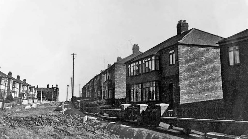
Olga Road in Sutton part of the ‘Kenwright estate’ prior to the completion of the road - Contributed by Ann Pigott

Olga Road part of the ‘Kenwright estate’ prior to the completion of the road

Olga Road in Sutton, St.Helens
PEASLEY CROSS LANE - This was so-named because roadside crosses used to be placed on highways so that travellers could stop and pray for their safe journey. 'Peasley' refers to the position of the cross and is derived from the Old English words ‘pese’ or ‘pease’.
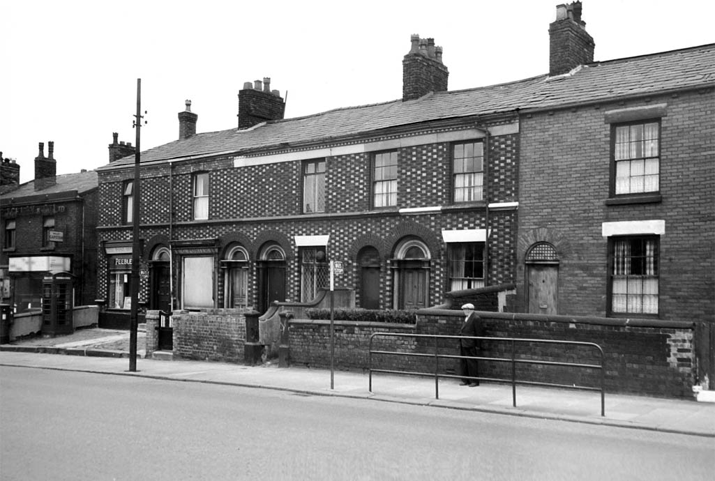
133 to 143 Peasley Cross Lane in 1959, half-way up the lane towards Sherdley Road with the Post Office to the left

133 to 143 Peasley Cross Lane in 1959, half-way up the lane towards Sherdley Road

133 - 143 Peasley Cross Lane in 1959
POWDER WORKS YARD / AVENUE (rear of the Farmers Arms pub near Normans Road - no longer exists) - It appears to have been an unofficial name and first appears in the 1881 Census as ‘Powder Works’ and then between 1891 and 1911 as ‘Powder Works Yard’. It was a narrow lane running up from Normans Road that opened out into a yard at the back and originally housed workers from Bickford’s Powder Works, from which it took its name. Bickford’s were a safety fuse manufacturer who used powder within their fuse design. Consequently in the 1939 Register the street is referred to as Fuse Works Yard with three properties (nos. 2, 4 & 6) shown. It was later referred to as Powder Works Avenue and in 1957 the three houses were earmarked for compulsory purchase and demolition, alongside some properties in Normans Road, Pye Street and Bold Road. The actual powder works / fuse manufacturers closed soon after WW1. You can find out more about Bickford’s Powder Works here.
PUDDING BAG (off Monastery Lane - no longer exists) - This was the local name for the cul-de-sac containing Woodcock Street and Railway Terrace that was enclosed in a triangle composed of two sides of railway lines. It had a single opening that served as a means of ingress and exit; like a narrow-necked muslin pudding bag with an opening at just one end.
PYE STREET (near Normans Road - no longer exists) - It was built in the early years of the 20th century and makes its first census appearance in 1911 with three properties numbered 1, 3 and 5. It was probably named after the Pye family who owned some houses in the area and may well have built those in Pye Street. In 1957 the three houses were earmarked for compulsory purchase and demolition.
ROBINS LANE - One of the oldest streets in Sutton. It has been suggested that its name was chosen because of the rural nature of the district at that time but this has not been confirmed. In the 1841 census there were only 6 properties in Robins Lane but this had become 31 by 1861 and 53 by 1891. At a St Helens Town Council meeting in August 1920 it was pointed out that the street was very narrow in places and a danger to pedestrians.
ROLLING MILL LANE (off Watery Lane) - Named after the Rolling Mill factory that opened in Watery Lane in 1860. The lane originally accommodated many of the factory's Welsh workers and was known initially as Copper Works Row. More here.
ROSE AVENUE (off Kent Road, near Sutton Park) - Like the adjacent Margaret Avenue, the short street was named after Princess Margaret (1930 – 2002) with Rose being her middle name. The street name was chosen by builders A. J. Kenwright of Robins Lane, who mainly chose names with Royal connections for the houses they built near Sutton Park.
ROUGHDALE AVENUE Sutton Manor (off Walkers Lane) - Named after the Roughdale Brick & Clay Company which was established around 1860. It closed in 2008 under the ownership of Ibstock Brickworks. The brick company took its name from four fields called ‘rough dales’ on the western side of Chester Lane on which it sited part of its works. These were identified as such in the will of Katherine Hawarden that was dated 1718/19.
SANDRINGHAM DRIVE (off Eaves Lane and Marina Avenue, near Sutton Park) - Named after Sandringham House in Norfolk, which has been owned by the Royal family since the 1860s. The name of Sandringham Drive was chosen by builders A. J. Kenwright of Robins Lane, who built some of the early houses in the street. They mainly picked street names with Royal connections for the houses that they built near Sutton Park.
SCORE & SCORECROSS - From around 1800, the main track through the Sherdley Hall estate and park has been referred to as the 'Score' or 'Hughes' Score'. The derivation is from the Old Norse word ‘Skor’, which means ditch. So it’s likely that the path originally followed a ditch. There is an alternative explanation in that in medieval times the word score referred to a strip of grazing land. In an article published in the St.Helens Newspaper (1/4/1938), it stated that 'the score, open to pedestrians, is, perhaps, the only rural walk to be found inside the St.Helens boundary.'
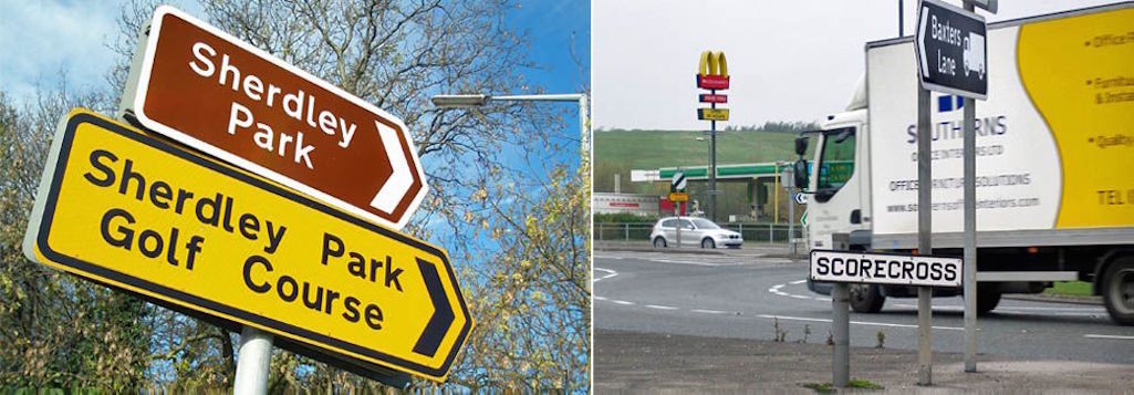
Left: Entrance to the Score into Sherdley Park from Elton Head Road; Right: Scorecross

Entrance to the Score into Sherdley Park from Elton Head Road and Scorecross

Entrance to the Score footpath from Elton Head Road and Scorecross sign
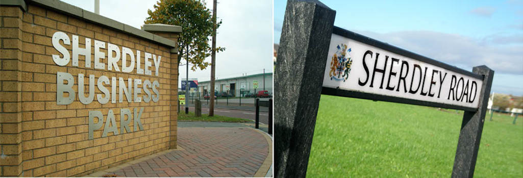
SHERDLEY PARK, SHERDLEY ROAD & ELL BESS LANE - In a St.Helens Reporter article of 1966, Sherdley Park was described as being the 'lung of the borough' of St.Helens (30/7/1966). The Sherdley estate has also been at Sutton's epicentre for hundreds of years, with the Lord of the Manor's residence traditionally being Sutton Hall, prior to the Hughes family taking over the estate.
The Sherdley name is one of the very oldest in Sutton with the Sherdley family traced back to 1303 when they were recorded as freeholders of Sherdley Hall, its orchard and gardens. In those fourteenth century years the family name was variously spelt 'Sherdilegh', 'Sherdelegh' or 'Schardeley' and simply refers to pasture-land. The first element of Sherdley is believed to be derived from the Old English for 'sceard', which means a gap in an enclosure. As most of the district in those days was moorland or moss, land that could be used for pasture was considered to be a valuable asset.
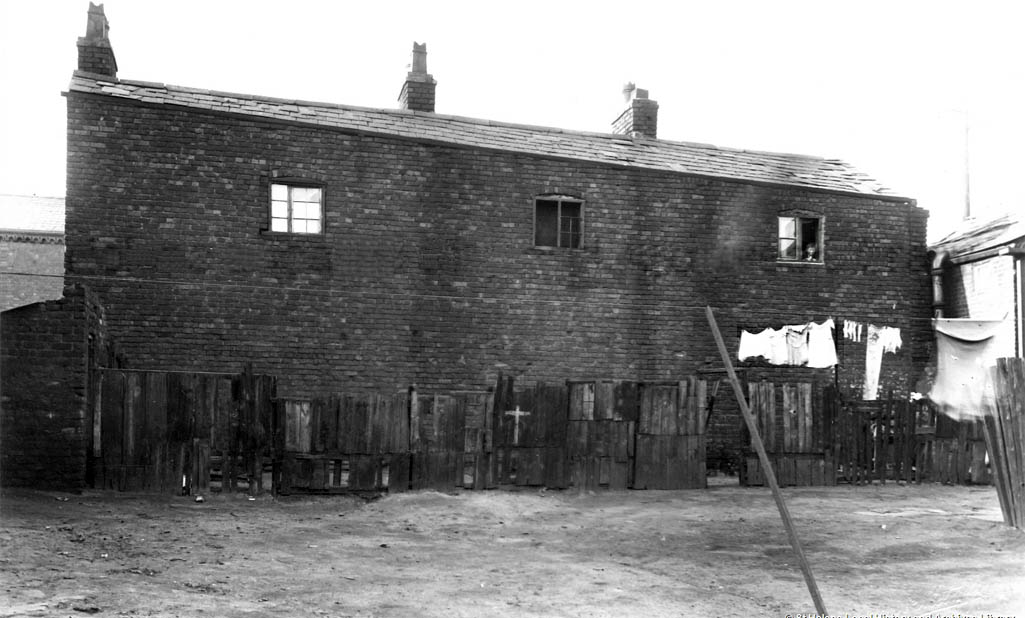
These properties in Sherdley Road c.1930s were considered unfit for habitation and pictured prior to their demolition

Properties in Sherdley Road c.1930s pictured prior to their demolition

Houses in Sherdley Road c.1930s
SMITH STREET (off Peckers Hill Road) - Named after railwayman John Smith who is thought to have arrived in Sutton in 1826 and who was a great benefactor to St. Anne's RC Church. The street was previously known as Paradise Row, Convent Row and Fenney's Lane.
SNOWDON GROVE (off Kensington Avenue & Sutton Park Drive) - Named after Antony Armstrong-Jones, 1st Earl of Snowdon, who was married to Princess Margaret from 1960 to 1978.
SPENCER GARDENS (off Robina Road, near Sutton Park) - Named after William Vose Spencer, who worked in the Sherdley Estate Office from 1912 to 1956. he leased the land and paid ground rents to the family. The name of Sandringham Drive was chosen by builders A. J. Kenwright of Robins Lane, who built some of the early houses in the street. They mainly picked street names with Royal connections for the houses that they built near Sutton Park.
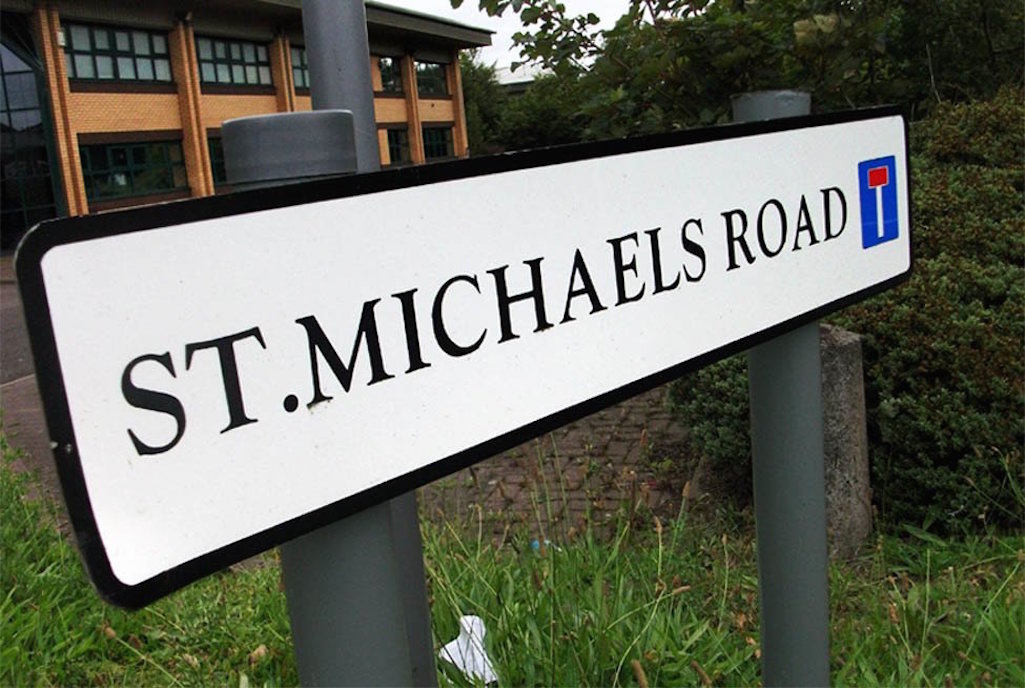
ST. MICHAEL’S ROAD (off Lea Green Road) - Named after the imposing St. Michael's House which was situated between Walkers Lane and Lea Green Road. It was built in Elizabethan times and had its own moat. More here.
Its name is derived from large oak trees that were situated on the triangle of grass at the junction of Lancots Lane and Sutton Road. It was locally known as Sparrow Park and there also used to be a street called Oak Tree in the vicinity which is mentioned in the 1841 census. 31 stone builder John 'Bally' Whittaker became licensee of the Oak Tree Inn in or near Ellamsbridge Road around 1880 and he also lived at Oak Cottage.

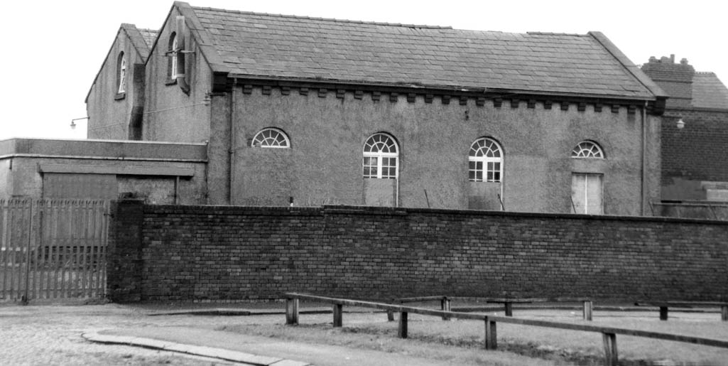
The Sutton Road pumping station / waterworks was a notable building on the corner of Oak Street and was opened c.1878

The Sutton Road pumping station on the corner of Oak Street was opened c.1878

The Sutton Road pumping station
THIEVES LANE (connects Marshalls Cross Road and New Street) - See entry for Eaves Lane above.
THORNHAM AVENUE (off Marshalls Cross Road / Marshalls Avenue) - Named after the demolished Thornham Villa, which first appears in an OS Map of 1908 and was situated near Sherdley Colliery.
TRAVERS ENTRY (between Bold Road and Bold Lane - Named after Travers Farm.
TUNSTALLS WAY (off Clock Face Road - opposite Clock Face Hotel) - Named after the nearby Tunstalls Farm which was listed on the 1849 OS map and still exists. During the early 20th century the farm was known to locals as Beesley's.
WATERDALE CRESCENT (between Robins Lane and Gerrards Lane) - With the large-scale growth of St.Helens during the nineteenth century, the town's bureaucrats were kept very busy naming new roads and renaming existing ones. The latter seems to have reached its peak around the turn of the new century with a number of Sutton streets changing their monicker. The reasons aren't always clear but sometimes it was to avoid confusion with other similarly named roads in St.Helens. So around 1904, Sutton's own Church Street in Pudding Bag became Woodcock Street and Church Lane became Monastery Lane. Sometimes only sections of a road were renamed as was the case with Norman's Road in 1899, where part of it became Houghton Road.
The wonderfully named Ditch Hillock was restyled Waterdale Crescent in 1898, probably because streets were expected to be suffixed 'road', 'street' or 'lane', again to avoid confusion. It was eponymously named after the Waterdale Dam reservoir and Waterdale House, the home of the two William Blinkhorns and later Alderman Arthur Sinclair, then Sutton Convent. Blinkhorn Snr. built Waterdale House during the early 1850s and Sinclair - the former secretary and superintendent of the St Helens and Runcorn Gap Railway - moved in about 1878. Waterdale Dam, off Gerards Lane, is these days known as the Monastery Dam or St.Anne's reservoir.

Left: Waterdale House, home of the Blinkhorns, Arthur Sinclair & Sutton Convent; Right: Waterdale Crescent around 1910

Left: Waterdale House, which was home to the Blinkhorn family, Arthur Sinclair and Sutton Convent; Right: Waterdale Crescent pictured around 1910

Waterdale House home of Sutton Convent & Waterdale Crescent c.1910
The most well-known buildings in Waterdale Crescent were the church social centre, known as the Blinkhorn Rooms and the Crystal Palace pub which closed in 1935. Much of the old Ditch Hillock / Waterdale Crescent has long been demolished and is much less populated these days. See Memories of Sutton articles: Arthur Normington? Who’s He? and Sutton Memories – I Remember by David Normington Gerrard for details of the shops and people in Waterdale Crescent during the 1940s and '50s.
WATERY LANE (connects Worsley Brow, Berry’s Lane and Cecil Street) - This is one of the oldest streets in Sutton, connecting Worsley Brow with Parr. Road nomenclature in centuries past tended to be based upon relevance to the location rather than a pretty name. If streets weren't given the name of a notable person or family who had lived in the area, they were named after something that was present. So Watery Lane was named after the nearby Sutton Brook and the regular flooding that it caused during winter. This was endemic in this low-lying area for many years during the nineteenth and twentieth centuries. Some houses had both their front and back doorways bricked up two feet high to prevent floods to the lower rooms.
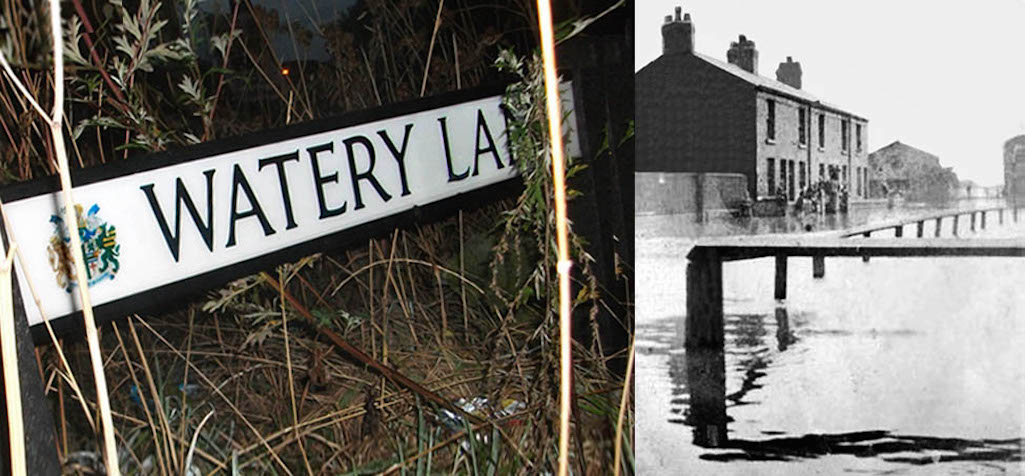
Watery Lane in Sutton has often been prone to flooding due to its close proximity to Sutton Brook

Watery Lane in Sutton Oak has a long history of flooding

Watery Lane has been prone to flooding
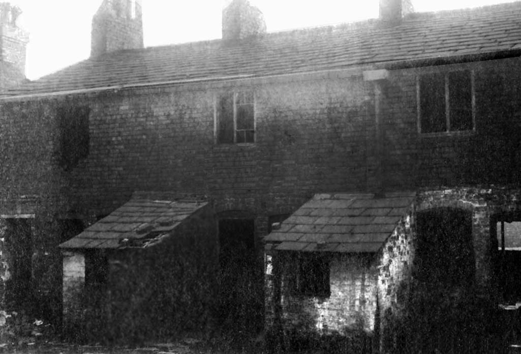
Rear view of 25, 27 & 29 Watery Lane c.1930 photographed by Jordan and Metcalfe and pictured prior to demolition

Rear view of 25, 27 and 29 Watery Lane c.1930 pictured prior to demolition

Nos. 25, 27 & 29 Watery Lane c.1930
The St Helens Reporter of December 3rd 1920 described the flooding of Watery Lane as the "eternal question". It described how Cllr. Mercer at a recent Town Council meeting had complained of nothing being done. He added that the residents "might be drowned out again this winter like rats" and called for the brook to be cleaned out so it held more water. One of the worst floods took place in 1934. Then on August 29th after heavy rainfall, flood water entered Watery Lane houses to the height of tabletops in kitchens and it also flooded the base of staircases. The St Helens Reporter (published 31/8/1934) dubbed it 'Day of the Great Splash':
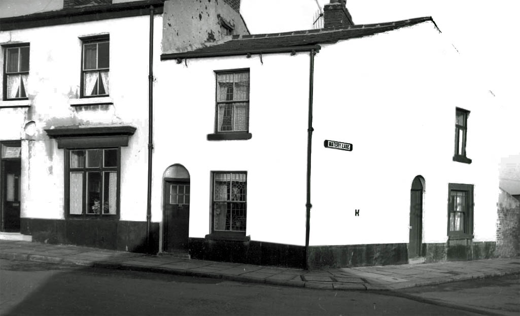
The corner of Watery Lane and nos. 23 to 25 Worsley Brow - which were subject to a compulsory purchase order - pictured in 1965

The corner of Watery Lane and 23 to 25 Worsley Brow in Sutton pictured in 1965

The corner of Watery Lane and 23 - 25 Worsley Brow pictured in 1965
WILLOW TREE AVENUE / WILLOW TREE PRIMARY SCHOOL (off Leach Lane) - Named after Willow Tree Farm which was listed on the 1849 OS map. The farm was owned by the Hughes family of Sherdley Hall and on August 31st 1843, Ellen Hughes got a court order at South Lancashire Assizes to eject tenant Thomas Bradshaw. On October 19th 1886 retiring farmer Jane Appleton sold by auction her farm stock which included 11 head of cattle, 36 tons of hay, 50 head of poultry, 3 stacks of white oats from 9 Cheshire acres, 1 acre of turnips and 3/4 acre of potatoes. In 1893 farmer James Rylance was charged with shooting a little boy named Stephen O'Brien from Walkers Lane. The present-day 'Willow Tree Farm' was built in 1935 and used recently as offices.
YEW TREE AVENUE (off New Street) - Named after Yew Tree Cottage which was situated in New Street, in between the cricket club and Eaves Lane. The avenue was build by the Heward family in 1937.

Appendix 1: Sutton Street Name Changes
A number of Sutton streets from the 19th century and early 20th, no longer exist and others have changed their name. For the benefit of family history researchers and others, this section will list streets which have been renamed with date if known.Church Road was renamed Monastery Road in 1902
Church Street (in Pudding Bag) was renamed Woodcock Street in 1902
Ditch Hillock and part of Gerrards Lane were renamed Waterdale Crescent c.1896
Gerrards Lane from Robins Lane to Worsley Brow were renamed Ellamsbridge Road c.1896
Ellbess Lane (formerly Hellbess Lane) was renamed Sherdley Road in 1902
Long Lane was renamed Reginald Road
Mill Lane (part from Marshalls Cross Road to Rainhill Road) was originally Sutton Lane, renamed Elton Head Road 1902
Normans Road (part of) was renamed Houghton Road in 1899
Rigbys Lane was renamed Gartons Lane in 1902
Thieves Lane was renamed Eaves Lane in 1902
Appendix 2: A - Z of Sutton Streets
Click Here to Download 'A to Z of Sutton Streets - 1841 to 1891’ - This document lists all of the streets contained within the 1841 - 1891 Sutton censuses. Click Here to Download 'A to Z of Sutton Streets - 1901' - This document lists all of the streets contained within the East Sutton and West Sutton wards contained within the 1901 census. Click Here to Download 'A to Z of Sutton Streets - 1911' - This document lists all of the streets contained within the East Sutton and West Sutton wards contained within the 1911 census.


