An Illustrated History of Old Sutton in St Helens, Lancashire
Part 35 (of 95 parts) - A - Z of Sutton Streets Part 1 (A - K)
Researched & Written by Stephen Wainwright ©MMXX Contact Me Research Sources
ANNE GROVE (off Marina Avenue, near Sutton Park) - Named after Princess Anne. This was chosen by builders A. J. Kenwright of Robins Lane, who mainly picked street names with Royal connections for the houses they built near Sutton Park.
ASSAM STREET (near Worsley Brow / Watery Lane - No longer exists) - Sutton was one of only two places in the country that had such a named street with the other being Assam Street in London, which still exists. It first appears in the East Sutton census in 1891, with just six houses listed in the 1901 census. The origin of the name is a little unclear but would certainly have been tea linked. In all probability the street took its name from an Assam tea advertising board that would likely have been on the end wall of the first house in the street and displaying into Watery Lane.


BAXTERS LANE (connects Robins Lane and Sutton Road) - These days most visitors to Baxters Lane are likely to be making their way to Morrisons supermarket. In past times it was the site of Sutton Oak Sheds, where small boys would gaze in awe at the magnificent locomotives stored and maintained there. Prior to the Sheds relocating to Baxters Lane, the district was largely agricultural land farmed by generations of Baxters, hence the street name. The most famous member of the family was Henry Baxter (1830 - 1886), the industrialist who owned a copper smelting plant and chemical works in Parr. The road was not named after Henry, however, as it pre-dates his factories. However, the story of Henry Baxter's rise is a good example of the changing nineteenth century times and how Suttoners proved able to adapt.

Baxters Lane signs and a small boy at the Sutton Oak Sheds, where Morrisons supermarket car park is now
Baxters Lane signs and Sutton Oak Sheds, where Morrisons car park is now
Baxters Lane signs and a small boy in front of the Sutton Oak Sheds
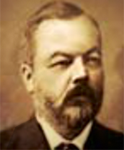
He also insisted on his son Henry (1830-1886), breaking the long Baxter agricultural line and taking a position in industry. It was a case of ‘if you can't beat them, join them’ and so sixteen-year-old Henry found himself working at Sutton Copper Works in Sutton Oak. Baxter was highly thought of by his partner William Keates and within nine years, at the age of just twenty-five, he became the firm's branch manager. In 1863 the ambitious Henry leased an idle smelting works in Parr from Keates and quickly made it profitable. Ten years later Baxter opened a chemical works next door and in 1883 the wealthy industrialist became the Mayor of St.Helens. All this through his Dad's farm becoming polluted!
Henry Baxter died on May 3rd 1886 aged 56 at Rann Lea, Rainhill, formerly the residence of John Marsh, another chemical manufacturer. Two hundred of his workmen attended his funeral and six of them acted as pall bearer. His thriving businesses did not long survive him, however. Baxter's copper works closed in the 1890s and his chemical works, although sold in 1890 to the United Alkali Co. for £100,000, closed early in the 20th century. The times were changing...yet again.

The Baxter memorial at the front of Rainhill Parish Church surrounded by iron railings
The Baxter memorial which is situated at the front of Rainhill Parish Church
The Baxter memorial at the front of Rainhill Parish Church

BETH AVENUE (off New Street) - Named after Elizabeth, the daughter of builder Richard Heward, who in 1937 built Beth Avenue as well as Freda Avenue, Yew Tree Avenue and Heward Avenue, as well as a few homes in New Street. Only a small number of homes were then built in Beth Avenue, which had farmland between it and Gerards Lane. During the 1960s when St.Helens Council elected to extend the street, creating what some dubbed 'Legoland' houses, the family complained about the continued use of the name 'Beth'. The part of the street that the Hewards had built eventually became Eton Hall Drive and the rest of Beth Avenue is now Ridgeway Drive. (Also see article: New Street Estates in How Sutton Has Changed Page)
BINNEY STREET (off Lancots Lane - No longer exists) - Almost certainly named after Hudson Atkinson Binney, who from 1868 to 1879 was the first agent (as managers were then known) of the Manchester and Salford Bank in Church Street, which became Williams Deacon’s. Binney was also a shareholder in the St.Helens Café and Recreation Company that was formed in September 1876 and three years later became the last manager of Sutton Glassworks. The street could not have been named after the second Vicar of Sutton, Maximilian Frederick Breffit Binney, as might have been thought, as Binney Street makes its first census appearance in 1881 and the vicar didn’t come to Sutton until 1889. Binney Street was created next to Blinkhorn Street and along with Dixon Street formed what was locally known as Colliers Square.

BLINKHORN STREET (off Lancots Lane - No longer exists) - Named after the two William Blinkhorns who managed Sutton Glassworks. They were industrialists but their grand-daughter married into the church and a great-grandson became a famous Arctic explorer, who was awarded a knighthood. You can read details of the family here. Blinkhorn Street was created next to Binney Street and along with Dixon Street formed what was locally known as Colliers Square.


BOSCOW CRESCENT (between Dawson Avenue and Gerrards Lane) - Named after Alderman Thomas Hill Boscow who served two terms as Mayor of St.Helens in 1928 and 1929. The controversial councillor was Chairman of the Watch Committee and also had a tobacconist's and newsagent's shop at 6 Junction Lane. See the ‘The Very Strange Case' of Alderman Boscow in Sutton Crime Part 2.

Boscow Crescent in Sutton c.1960 photographed by Frank Sheen and named after Thomas Hill Boscow
Boscow Crescent in Sutton c.1960 photographed by Frank Sheen
Boscow Crescent in Sutton c.1960
CARNEGIE CRESCENT (off Ellambridge Road) - Originally Carnegie Street, it was named c.1906 after philanthropist Andrew Carnegie who had paid for Sutton Library to relocate there.

One and two bedroom flats in Carnegie Crescent which were photographed about 1970
One and two bedroom flats in Carnegie Crescent photographed c.1970
Carnegie Crescent flats in 1970
During the 19th century, there was a pub, street, railway station, cottage and bridge that bore the name of Clock Face. The inn is thought to have been the derivation of the name as it displayed a very large clock over its front door. Many pubs and beerhouses took their monickers from nicknames bestowed on them by their customers, and this was probably the case with the Clock Face Inn. The first known reference to it was in 1800 when publican Thomas Grace was awarded his license. Clock Face Cottage in Clock Face Road was built in 1821 and the first census of 1841 includes a reference to Clock Face.
The railway station which opened in 1852 put Clock Face firmly on the map. Clock Face Road is one of the oldest streets in the district and research by Paul Challoner suggests that the advent of the railway and its bridge changed its original route. Prior to the railway, Clock Face Road doglegged to the right towards Tunstalls Farm and then turned to meet up with the road's present-day route beyond the bridge. The present pub opened in 1909 with a smaller, more attractive clock gracing its frontage. The Clock Face station finally closed in 1951, although Clock Face Crisps kept the name in the public eye. Appropriately in 1985 its owner James Lawrence Snr. left £100 in his will to the staff of the pub, whose predecessor had given the crisp firm its distinctive name.

Original Clock Face Inn clock
Mrs. Carter is stood in Mill Lane, directly opposite their house at 109 Mill Lane. Crane Avenue has been cut in on the left from Mill Lane, with all the sewerage pipes laid out. The houses in Mill Lane from 110 to number 88 to the left and right of her were to follow on next in this local construction. The view is across the long-gone ‘Bottom Dam’ over what is now Catterall Avenue and on the other side, Belvedere Avenue. To the left of the gas lamp you can seen the white top of the Gerards Lane bridge of the Liverpool /Manchester Line, and to its left the large St. Annes Villa, with Railway Terrace in Pudding Bag to the right.

Mrs. Carter stands in Mill Lane with Crane Avenue construction and St.Annes church and bottom dam behind her
Mrs. Carter stands in Mill Lane with construction of Crane Avenue behind her
Crane Avenue construction c.1929
CRAWFORD STREET & CRAWFORD CLOSE (off Gorsey Lane, Clock Face) - Named after the Earl of Crawford, who was chairman of the Wigan Coal and Iron Co., owners of Clock Face Colliery. Originally Crawford Street was for the use of the miners, who during the colliery's early years, paid a subsidised rent of 6s. 6d. a week. There also was a house called ‘Crawford Villa’ in Gorsey Lane. Its occupiers included James Anderton, manager of Sherdley Colliery, and Mr. H. Price, whose wife hosted garden parties in aid of the Clock Face branch of the Conservative Party.
DELPHWOOD DRIVE (off Sherdley Road) - DELPH WOOD housing estate off New Street / Ridgewood Drive, DELPH HOLLOW WAY (off Scorecross) & DELPH COURT (Sherdley Business Park) - Named after the Delph Woodland in Sherdley Park which during the 19th and early 20th centuries featured an old water-filled pit which became a popular place to commit suicide. More here.

DITCH HILLOCK - See entry for Waterdale Crescent
DIXON STREET (off Lancots Lane - No longer exists) - Possibly named after glass bottle manufacturer Frederick Dixon-Nuttall, who was a Liberal Councillor for West Sutton and who became Mayor of St.Helens in 1891 and again in 1902.

EAVES LANE (connects Marshalls Cross Road and New Street) - Originally known as Thieves Lane with all 19th century Ordnance Survey maps, including the one below from 1849, referring to it by that name. In 1902 a number of St.Helens’ streets were renamed for one reason or another and Thieves Lane was one.

Left: Eaves Lane in Sutton, St.Helens in 1964; Right: OS Map from 1849/50 when it was known as Thieves Lane
Left: Eaves Lane in 1964; Right: 1849/50 OS Map when known as Thieves Lane
Eaves Lane 1964 and 1849 map

Ivy Cottage at the top of Eaves Lane in Sutton which was demolished in 1969 and pictured around 1910
Ivy Cottage at the top of Eaves Lane in Sutton which was demolished in 1969
Ivy Cottage in Eaves Lane, Sutton

Two photos of Ivy Cottage at the top of Eaves Lane pictured during the 1960s not long before it was demolished
Two photos of Ivy Cottage at the top of Eaves Lane during the 1960s

Eaves Lane during the 1960s
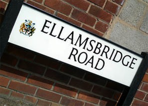
The bridge crossed Sutton Brook, which at this point was locally known as the School Brook. The waterway then hugged the road and bent around to Watery Lane. It was later straightened and deepened to reduce flooding. These days Ellamsbridge Road extends to Robins Lane but originally the stretch to Worsley Brow from Robins Lane was part of Gerards Lane. It was probably renamed c.1896 when Ditch Hillock was renamed Waterdale Crescent and extended to Robins Lane.
The street's prefix is named after Henry Ellam, who was an influential figure in Sutton in his day, and who also owned property in Parr and Lymm. Ellam's will, dated 16th June 1796, has survived and one of his executors was his friend Thomas Greenall of the brewery family. Henry Ellam's estates were bought by Michael Hughes of Sherdley Hall in 1797 for £1463. The most notable property was Ellam's House, a.k.a. Tripe Shaws, which dated back to the 18th century and was demolished in the mid-20th century.

ELLBESS LANE (connects Marshalls Cross Road and New Street) - See entry for Sherdley below
ELLEN STREET (off Robins Lane) - Named after Ellen Fisher (née Smith), who was mother and grandmother of the builder Fisher family (see entry for Fisher Street) who built the houses in Ellen Street. She was also related to John Smith, a great benefactor to St. Anne's RC Church.
ELTON HEAD ROAD - Named after the Eltonhead family who lived at Eltonhead Hall and who have a direct family connection with both the English and American civil wars and two US presidents. You can view the article on the Eltonheads here.
FACTORY ROW (Ravenhead) - This first makes an appearance in the census of 1851 and was so-called because it provided housing for workers of the British Plate Glass Company in Ravenhead, which was then part of the Sutton Township.

Factory Row in Ravenhead pictured around the 1950s and built in the mid-19th century for workers of the British Plate Glass Company
Factory Row, Ravenhead pictured in the 1950s and built in the mid-19th century
Factory Row in Ravenhead c.1950s
Fisher built St. Joseph’s in Peasley Cross in 1877/8 and St. Anne’s girls’ school in 1884, dying on March 29th 1913 aged 81 years. James’s brothers Thomas, John and Peter were all builders or carpenters in Sutton. His niece Elizabeth and brother John are profiled in the Sutton Crime Part 2 page within the article 'The Seduction Of A Sutton Builder's Daughter'. James’s brother Peter also ran the Wheatsheaf Inn in Lionel Street for a while and his nephew John (son of brother Thomas) had a bankruptcy receiving order made against him in March 1894.
On June 1st 1869 the Sanitary Committee of the Sutton Local Board inspected the newly-paved Fisher Street and its original houses were also likely to have been built that year.
FOUR ACRE LANE (between Clock Face Road and Chester Lane) - Named after Four Acre Farm, originally Rigby's Farm (see Gartons Lane entry). On May 28th 1969 the last of the 151 homes at Four Acre Lane were officially handed over to St Helens Council. The £500,000 scheme (£8½m in today's money) had begun in September 1967. A further 303 homes were built by St Helens Corporation between 1969 and 1971 at a cost of over £1m.

Plan of Four Acre Farm (Rigbys Farm), Clock Face - Contributed by Terry Callaghan
Plan of Four Acre Farm (also known as Rigby’s Farm) in Clock Face
Plan of Four Acre Farm (Rigbys Farm)
GARTONS LANE (connects Chester Lane and Clock Face Road) – The road which was originally known as Rigby’s Lane, after Rigby's Farm owned by Thomas Rigby, was named after the Garton family. John Garton occupied Tunstalls Farm on the opposite side of Clock Face Road in the middle to late 19th century. He was a member of the Sutton Local Board during the 1860s which administered the township and collected rates. Garton also served on the Prescot Board of Guardians representing Sutton. There was also a William Garton who owned land in the lane as well as Rigby's Farm and Mary Garton who was connected to the Lamb millers at Sutton Mill.
GERRARDS LANE - Believed to have been named after the Sutton family, including Thomas and Hannah Gerrard, who lived near to Leach Hall and the Intersection bridge.
GLAMIS GROVE (off Dinorben Avenue, near Sutton Park) - Named after Glamis Castle in Angus in Scotland, the childhood home of Elizabeth Angela Marguerite Bowes-Lyon (1900 – 2002), more commonly known as Queen Elizabeth The Queen Mother. Glamis Castle was also the setting for Shakespeare’s Macbeth.
GOODBAN STREET (off Ellamsbridge Road) - Likely to have been named after market gardener / nurseryman James Goodban of 89 Hoghton Road / Norman’s Road, who also built two houses for his gardeners which became known as Goodban’s Cottages.
GRACE'S SQUARE (off New Street and Mill Lane - demolished) - Named after pottery manufacturer and landowner James Grace who ran a pottery firm in Marshalls Cross and owned much land in Sutton, including 26 houses in Baxters Lane. In January 1871 Grace bought the old Sutton Workhouse opposite St Nicholas Church for £270 (that had also served as the first Sutton National School) and Grace’s Square was built on the site shortly afterwards. The Square was demolished in the late 1960s and Sherdley Primary School now occupies the site. There also used to be a Grace Street in east Sutton.
GRIMSHAW STREET (off Mill Lane) - Named after the Grimshaw family who are thought to have owned land on the north side of Mill Lane. The family were benefactors to St. Anne's RC Church with Richard Grimshaw paying for the Lady Chapel. The alabaster altars of this and a second altar dedicated to St. Paul of the Cross were later donated by his widow Elizabeth in memory of her husband. Their descendants had a number of business interests, including owning and operating a large lodging house off Salisbury Street in St Helens. There were a number of different charges for the nightly lodging, ranging from upstairs single rooms with beds, communal rooms with beds, to sleeping downstairs in the large open room, which had the cheapest cost. In this communal room for a penny a night, people could use a rope line that was stretched across.
Overcoats were placed over the line (or kept on) to cushion the rope and then the customers sagged on it with their arms positioned over the rope, being almost in a sitting position. After WW2 the property was taken over by the Salvation Army. The owner Frederick Grimshaw and wife Helen lived at the now-demolished large detached house at 145 Mill Lane on the corner with Mill Brow which was later occupied by his daughter Ethel Grimshaw after marrying John Tootill at St. Anne's in 1927. No. 14 Grimshaw Street had an interesting history and was probably linked to St. Anne’s Church. Augustine Borrows of the loco family lived there in the 1890s and John Coffey had a famous pools win in the house in 1952.

Grimshaw Street in Sutton, St.Helens with house numbers 10 to 24 - no. 14 had an interesting history
Grimshaw Street in Sutton, St.Helens with house numbers 10 to 24

Grimshaw Street in Sutton
HALL LANE (off Gorsey Lane, Bold) - Named after Bold Hall. Its stable range and associated dwelling house, now a farmhouse, still exist at Home Farm, off Hall Lane. There's a full history of Bold Hall here.


IRWIN ROAD - Named after the Irwin Scottish lowland clan as Alice Kenwright, the wife of street builder Alfred Kenwright, had Scottish ancestry. Similarly nearby Glamis Grove is derived from Glamis Castle. The first planning application for 21 ‘cottages’ for Irwin Road was made in February 1934. More were soon built as the 1939 Register (taken just after the start of WW2) details 69 houses. During the 1940s St.Helens Corporation acquired land in Irwin Road from the Sherdley Estate and in 1946 the Kenwright family built more houses there.

JOSEPH STREET (off Peckers Hill Road / Smith Street) - The late Sutton historian Frank Bamber believed that Joseph Street was named after Elizabeth Prout, the Superior General at Sutton's Holy Cross Convent, and who was renowned for her work supporting poverty-stricken Manchester mill girls. Elizabeth took the name of Mother Mary Joseph, which is where the Joseph link is made. St.Anne's church archivist Sister Dominic Savio Hamer considers it more likely to have been named after Joseph Paul Smith, the son of church benefactor John Smith, who became a Benedectine monk.
KEATES STREET (off Watery Lane) - Named after William Keates and his son Joseph who along with the Newtons, owned the Copper Works in Sutton Oak and the Rolling Mill factory. The Keates's gave employment to thousands of Suttoners over the years and the name of the Coppersmiths Arms in Watery Lane underlines the local importance of these industries. You can view histories of the plants here.
KENT ROAD (off Marina Avenue, near Sutton Park) - Named after Prince George, Duke of Kent (1902 – 1942), the fifth child of King George V. He held the title of Duke of Kent from 1934 until his death in an air crash in 1942. Princess Marina of Greece and Denmark was his wife and she gave her name to Marina Avenue. The name of Kent Road was chosen by builders A. J. Kenwright of Robins Lane, who mainly chose street names with Royal connections for the houses they built near Sutton Park.

Princess Marina, Duchess of Kent and Prince George, Duke of Kent who have Sutton streets named after them
Princess Marina and the Duke of Kent have Sutton streets named after them
Princess Marina (Duchess of Kent) and Prince George, the Duke of Kent

Lancots Lane with Watery Lane on the right photographed by Frank Sheen in 1960
Lancots Lane with Watery Lane on the right pictured in 1960
Lancots Lane in Sutton in 1960

Appendix 1: Sutton Street Name Changes
A number of Sutton streets from the 19th century and early 20th, no longer exist and others have changed their name. For the benefit of family history researchers and others, this section will list streets which have been renamed with date if known.Church Road was renamed Monastery Road in 1902
Church Street (in Pudding Bag) was renamed Woodcock Street in 1902
Ditch Hillock and part of Gerrards Lane were renamed Waterdale Crescent c.1896
Gerrards Lane from Robins Lane to Worsley Brow were renamed Ellamsbridge Road c.1896
Ellbess Lane (formerly Hellbess Lane) was renamed Sherdley Road in 1902
Long Lane was renamed Reginald Road
Mill Lane (part from Marshalls Cross Road to Rainhill Road) was originally Sutton Lane, renamed Elton Head Road 1902
Normans Road (part of) was renamed Houghton Road in 1899
Rigbys Lane was renamed Gartons Lane in 1902
Thieves Lane was renamed Eaves Lane in 1902
Appendix 2: A - Z of Sutton Streets
Click Here to Download 'A to Z of Sutton Streets - 1841 to 1891’ - This document lists all of the streets contained within the 1841 - 1891 Sutton censuses. Click Here to Download 'A to Z of Sutton Streets - 1901' - This document lists all of the streets contained within the East Sutton and West Sutton wards contained within the 1901 census. Click Here to Download 'A to Z of Sutton Streets - 1911' - This document lists all of the streets contained within the East Sutton and West Sutton wards contained within the 1911 census.